OOI Mapping Cruise 2008
Once and Future Oceanographer
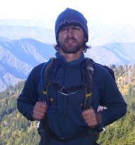
As a recent Geology graduate of the College of Charleston who is intrigued by Oceanography specifically Marine Geology, I jumped at the opportunity to take part in this cruise. My undergraduate advisor, Dr. Leslie Sautter emailed me about the opportunity after attending a conference in Portland, Oregon in June. She informed me that Dr. Delaney and Dr. Kelley were in need of people to process the multibeam data that was going to be acquired while on the cruise. I wanted to participate not only because I am applying to the University of Washington’s School of Oceanography in the spring, but because I would have the opportunity to partake, God willing, in one the cruises that could quite possibly change how Oceanography will be studied in the future. Imagine a teacher being able to acquire real-time data from the bottom of the ocean some 60 km offshore of Oregon, while teaching a class in Pittsburgh, Pennsylvania via the internet. This would be the opportunity of a life time and I knew that I could not let this pass by.
Cruise
Now that I have spent a week aboard the R/V Thompson I can honestly say that I had no clue what I was getting into. I thought my donation to the cruise along with fellow College of Charleston graduate Andrew Kennedy, would be to teach how to process the multi-beam data collected using the ship’s EM 300 to survey potential sites for the node and sensor locations…… not quite. Along with processing we have been keeping a log of all the ship’s scientific activity in relation to our speed, course over ground, latitude, longitude and time in relation to Greenwich Mean Time. We have also been in charge of time crunching or maximizing the amount of data we can collect with the time available but also be able to adjust for further time constraints when things do not go as planned. For those of you reading this that have not been to sea for scientific purposes it is expensive and time is money. Everyone is trying to test their new equipment like Sentry and Towcam so we can collect as much data as possible to better inform us in our decision making processes.
COVE
One new software tool, still under development introduced to me and that is key for the cruise and the RSN Ocean Observatory Initiative is COVE. COVE stands for Collaborative Ocean Visualization Environment, and this program was designed specifically for visualizing the planning of research cruises similar to this. The best part about learning this software is that it has never been used to the extent to which we are using it; we are the first people to be putting the software to the test. We are partaking in the creation, alteration and debugging of this software. Since I am not a computer person, it takes me awhile to get to know what I can and can’t do on a computer program. But I thoroughly enjoy the interactive ability and ease with which this program can be used. Imagine software that is user friendly like Google Earth, but that can be personalized to your cruise’s needs, for example planning a very expensive two-week scientific expedition.
I feel like I have learned so much about the geologic processes that have shaped and are still shaping the west coast. There is still so much that we can learn about this area and I feel like this initiative is a great place to start. In closing, I feel that this cruise has further solidified my desire to attend graduate school whether it is here or at another school. I would like to personally thank everyone directly and indirectly involved in making this cruise possible!
Related Content
Voices
- Newbies, Oldies and 21st Century Oceanography
- Going to Sea
- Once and Future Oceanographer
- The Oceans: Medicine Chest for the World
- When Your Home Bobs
- Seas of Opportunity
- Voices of the Fishes
- Oceanography as an Opportunity to Contribute
- The Water Column
- Ocean Heritage Guides this Oceanography Major
- Theater in the Round
